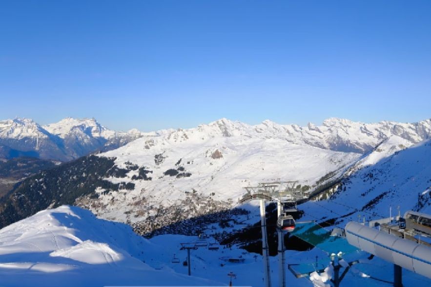
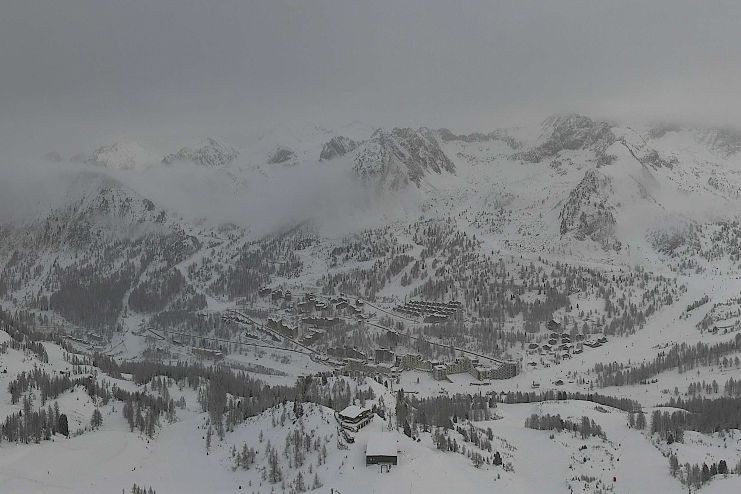
Weather to ski is currently in Bettmeralp in the Swiss Aletsch Arena region where there is still a veil of high cloud this morning, which is expected to dissipate as the day goes on.


Got a burning question about weather or snow conditions in the Alps?
Contact us and we'll do our best to answer it...
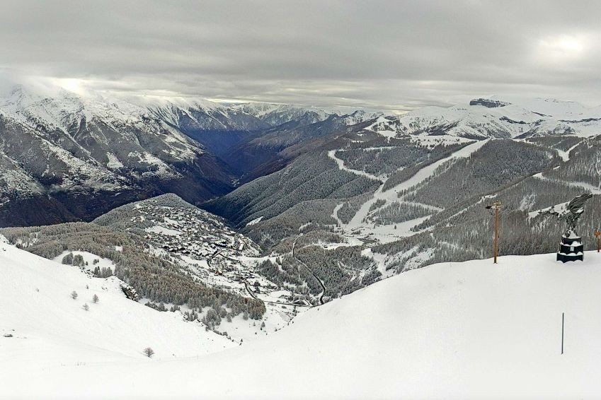
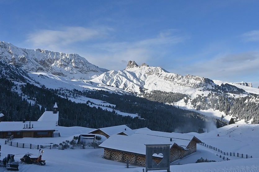
Updated: 10am Wednesday 17 December 2025 – Significant fresh snow has fallen in the far south-western Alps in the last 36 hours...
Weather to ski is currently in Bettmeralp in the Swiss Aletsch Arena region where there is still a veil of high cloud this morning, which is expected to dissipate as the day goes on.
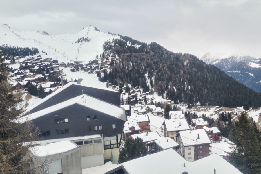
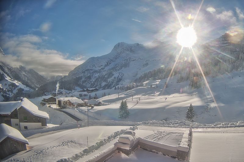
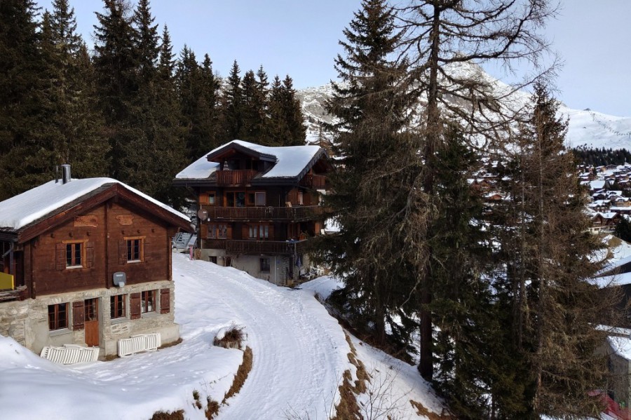 A veil of high cloud this morning in Bettmeralp in the Swiss Aletsch Arena, but sunnier skies are expected later today. This is the view from the Hotel Waldhaus – 17 December 2025 – Photo: weathertoski.co.uk
This cloud is the remnant of a storm which dropped significant snow across some south-western parts of the Alps yesterday, with over 50cm in the far southern Piemonte areas of Prato Nevoso and Limone Piemonte.
Some other south-western regions, including Isola 2000, Sestriere and Alagna, also saw some useful snow but most of the Alps have been dry, if rather cloudy, over the last 36 hours.
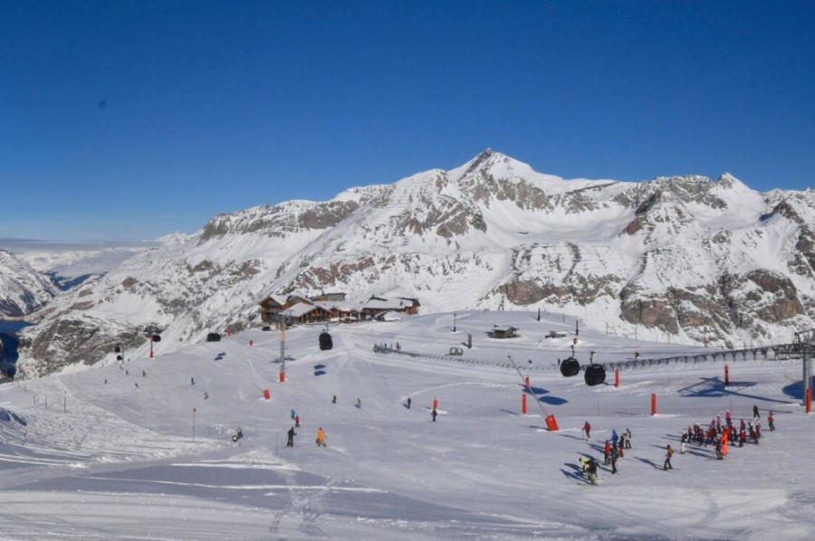
 Significant new snow in the southern Piemonte. This is Limone – 17 December 2025 – Photo: bergfex.com
Today there are a few light flurries in the central and eastern Italian Alps (Dolomites), however most regions will be dry with variable cloud but generally increasing sunshine later in the day.
Looking a bit further ahead, it looks like there could be further significant snow in the south-western Alps (especially the Italian Piemonte) in the run up to Christmas, though widespread significant snow in the Alps is unlikely any time soon.

Still some good skiing on offer in the Alps but more snow is now needed…
The weather in the Alps is about to turn much milder...
Just how good are early season snow conditions in the Alps right now?
If you enjoy reading our updates - please feel free to support us:


The 2024-25 North American ski season saw slightly below average snowfall overall, but the Northeast had its snowiest season since 2016-17.
Read our full review of the 2024-25 ski season, and find out who got the most snow in North America...
The 2022-23 alpine ski season was relatively snowless and exceptionally mild, although some resorts fared better than others.
Read our full review of the 2022-23 ski season and find out who got the most snow in the Alps...
Bad Gastein: 5 reasons to visit this 'forgotten' Austrian gem
23 March 2024
Bad Gastein dropped off the radar for a while with British skiers but is now making a comeback. Here are 5 reasons why you should consider it for your next ski trip...
Top 5 pistes in Les Arcs
8 June 2022
Les Arcs boasts some of the finest and most famous pistes in the Alps. Here are five of our favourites...
Top 5 early season ski resorts - Italy
22 October 2020
Here are our top 5 ski resorts for an early season ski holiday in Italy...
Snowfall patterns in the French Alps
16 September 2020
Ever wondered why some areas of the French Alps get more snow than others?
Updated: 4pm Tuesday 16 December 2025 – Fresh snow in the south-western Alps today...
Weather to ski is currently in Bettmeralp in the Aletsch Arena ski region in the Swiss Valais, where it is cloudy today with the odd flake of snow.
 Cloudy with the odd flake of snow today in Bettmeralp in the Swiss Aletsch Arena – 16 December 2025 – Photo: weathertoski.co.uk
This area is on the margins of a disturbance that is currently delivering snow to some south-western parts of the Alps, notably the southern Italian Piemonte, where 15-30cm of snow has already fallen in Prato Nevoso and Limone Piemonte with more than 50cm possible by Wednesday morning.
Some other parts of the southern French and western Italian Alps are seeing some useful snow from this storm, including Auron (pictured below), Isola 2000, Sestriere and the Monte Rosa region.
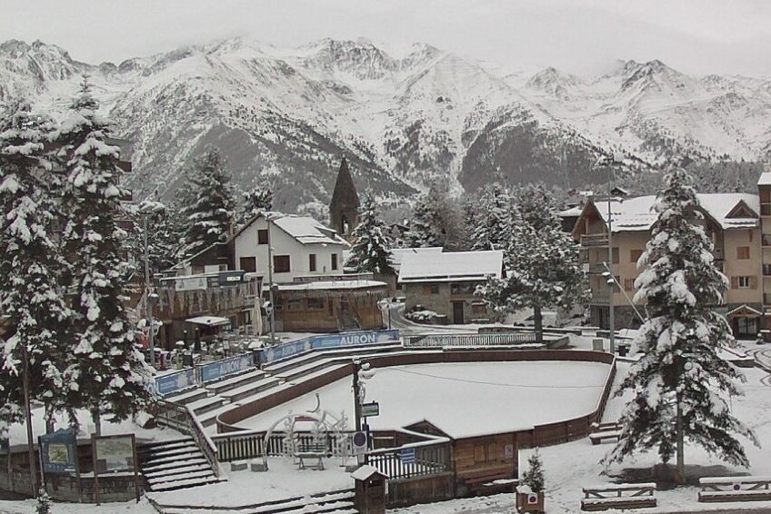 Significant fresh snow in the far southern French Alps. This is Auron – 16 December 2025 –Photo: auron.com
For most of the Alps though, it is dry with variable cloud and the best of any sunshine the further north-east you are.
The storm currently affecting the south-western Alps will move away tomorrow, with mostly dry (though not always sunny) weather expected in the Alps over the next few days.
The best snow conditions for the rest of this week are going to be in those south-western areas that have seen plenty of snow from the current storm. Elsewhere in the Alps there is plenty of good piste-skiing on offer but, aside from in a few north-western ski resorts (e.g. Avoriaz), snow levels are generally far below where they should be for the time of year.
Updated: 3.30pm Monday 15 December 2025 – Significant snowfall imminent in some south-western parts of the Alps...
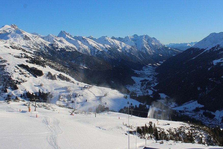
Weather to ski is currently in Bettmeralp in the Aletsch Arena ski area in the Swiss Valais, where it was sunny this morning but with high cloud spreading in from the south this afternoon. This cloud comes ahead of a disturbance that will bring snow to some south-western parts of the Alps tonight and tomorrow.
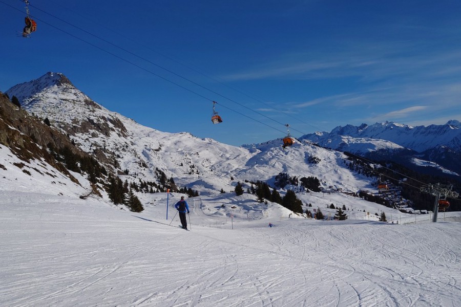 Great fast cruising on relatively empty pistes in Bettmeralp in the Swiss Aletsch Arena this afternoon – 15 December 2025 – Photo: weathertoski.co.uk
Snow conditions here in Bettmeralp are pretty good for mid-December, with fast grippy pistes and very little (if any) ice. The situation is similar across many other parts of the Alps, with lots
of good piste-skiing on offer even if snow depths are generally below par for mid-December.
The best snow conditions in the Alps will soon be in the south-west, where conditions will improve dramatically over the next few days. The far south-western Italian ski resorts (Limone Piedmonte,
Prato Nevoso) will see some very significant snowfall, with perhaps as much as 50-70cm by Wednesday morning.
The far southern French Alps will also do well, with around 30-40cm possible during the same period. Other ski resorts that will see some useful snow include Sestriere and the Milky Way area, which may see 10-20cm, as might the Monte Rosa region, perhaps with more towards Alagna.
The northern French Alps (e.g. Chamonix, Avoriaz), most of the Swiss Alps away from the far southern border regions, most of the Austrian Alps and the eastern Italian Alps will stay dry, although some veils of high clouds will obscure the sun at times.
The weather in the Alps should improve on Wednesday and Thursday before a new disturbance approaches the south-west later this week.
Updated: 9am Saturday 13 December 2025 – Mostly sunny in the Alps, with some snow due in the far south-west early next week...
It’s another glorious day across most of the Alps today, where at least 270 ski areas are open this weekend. The weather in the Alps will remain mostly sunny tomorrow before a small disturbance brings snow to some south-western areas late on Monday and on Tuesday.
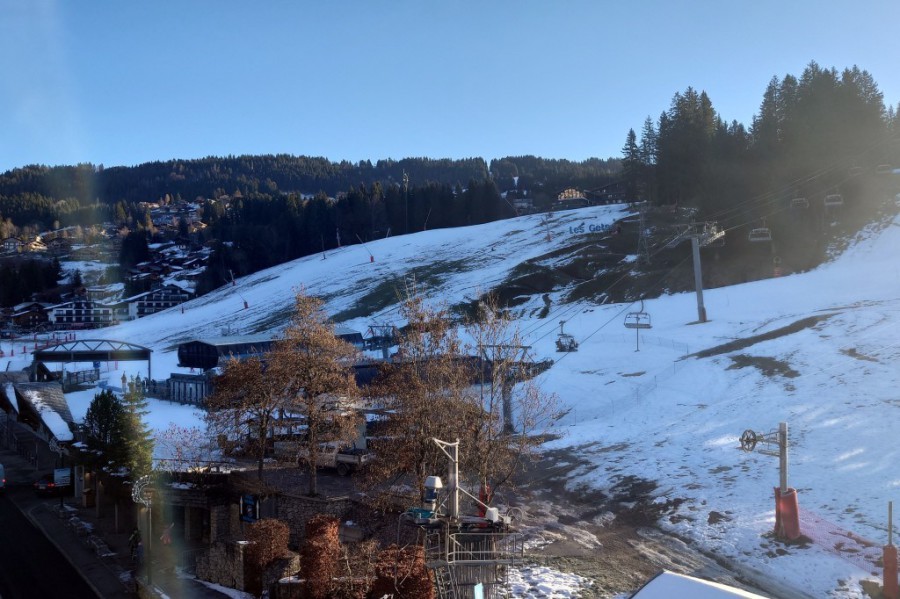 Looking a bit threadbare at resort level in Les Gets this morning but there is good snow cover higher up – 13 December 2025 – Photo: weathertoski.co.uk
This snow will be very localised, with any meaningful accumulations confined to the far southern French Alps (e.g. Isola 2000, Queyras) and the south-western Italian Alps (e.g. Prato Nevoso, Limone Piemonte). Most of rest of the Alps will remain dry all week.
Snow conditions in the Alps remain reasonable in most areas, despite generally below par snow cover. Weather to ski is currently in the Les Gets in the Portes du Soleil, one of the few areas in the Alps where there are still above average snow depths at altitude (especially in and around Avoriaz). However, despite those exceptional November storms, snow cover is becoming threadbare at resort level.
Check out our latest snow report for a more detailed country by country round-up of snow conditions in the Alps and beyond…
Updated: 10.20am Thursday 11 December 2025 – Remaining dry in the Alps today, but with variable cloud cover...
Weather to ski is currently in Flaine, courtesy of the Hotel Rocky Pop, where the weather is bright this morning but with quite a lot of high cloud making the sun a little hazy.
 Plenty of snow at resort level in Flaine, which is already open for the season every day of the week – 11 December 2025 – Photo: weathertoski.co.uk
Flaine was one of the areas that saw a lot of snow in late November (1.5m in just 3 days at the top), meaning that last Sunday’s rain has had relatively little impact on snow depths, and there is still ample cover from top to bottom.
For now, it is just Flaine itself that is open for skiing, with the rest of the Grand Massif (Les Carroz, Samoëns, Morillon etc) joining the action this weekend.
More generally, high pressure remains in charge of the weather in the Alps, meaning that it will be dry today with plenty of sunshine. However, a very weak decaying weather front is leading to some substantial areas of high cloud that will drift around and mask the sun in places, especially in the northern Austrian Alps. It is cooler today than yesterday, but it is still mild, with freezing levels typically around 2400-2700m.
For the next few days, the weather in the Alps will remain dry. This will continue into next week, with lots of sunshine, mild temperatures and just a few cloudier interludes from time to time.
Over 200 resorts in the Alps are open today, around 10 of which are now offering 100km or more of pistes. Ischgl continues to lead the way with 195km now open, followed by Zermatt-Cervinia with 192km and Val Gardena with 156km.
Piste conditions generally remain quite hard-packed.
Updated: 10.30am Wednesday 10 December 2025 – Still mostly fine and very mild across the Alps...
Weather to ski is currently in Flaine, courtesy of the Hotel Rocky Pop, where the weather is mostly sunny this morning, with just a few discreet areas of mid-level cloud drifting around.
 Sunny weather, plenty of snow and empty pistes here in Flaine this week. This is the view from the 9th floor of the Rocky Pop Hotel – 10 December 2025 – Photo: weathertoski.co.uk
Flaine was one of the areas that saw a lot of snow in late November (1.5m in just 3 days at the top), meaning that last Sunday’s rain has had relatively little impact on snow depths, and there is still ample cover from top to bottom.
For now, it is just Flaine itself that is open for skiing, with the rest of the Grand Massif (Les Carroz, Samoëns, Morillon etc) joining the action this weekend.
Elsewhere in the Alps, it is also mostly sunny and very mild today, with freezing levels typically around or a little above 3000m. Indeed, the weather in the Alps will remain settled for the rest of this week and into next week, with plenty of sunshine and just a few areas of cloud here and there.
Over 200 resorts in the Alps are open today, with around 10 of these now offering 100km or more of pistes. Ischgl continues to lead the way with 195km now open, followed by Zermatt-Cervinia with 192km and Val Gardena with 156km. On the whole, pistes are hard-packed.
Updated: 9am Tuesday 9 December 2025 – Mostly sunny and very mild in the Alps...
The weather in the Alps is mostly sunny and very mild today, with just some low cloud to contend with here and there in some of the valley bottoms. Freezing levels will be well above 3000m today, making it feel particularly pleasant at altitude.
 Beautiful weather in the Alps today. This is Verbier – 9 December 2025 – Photo: verbier.ch
The rest of this week will also be dry with lots of sunshine and just a few areas of cloud drifting round. Temperatures will drop a little, at least for a while, but it will still stay relatively mild for the time of year.
Looking even further ahead, there is little sign at this stage of any significant snow in the Alps before Christmas, though this could change.
Snow conditions in the Alps did take a bit of a hit on Sunday when the milder air moved in, especially where it rained (mostly in the northern French, Swiss and western Austrian Alps).
Luckily, the areas where it rained the most (e.g. Portes du Soleil) had plenty of snow from the November storms, so it is only the lowest slopes that are now looking a bit threadbare. Above 1300m or so, the snowpack in these north-western parts of the Alps still looks healthy.
More generally, there is still lots of good piste-skiing on offer across the Alps, even if snow depths are generally unremarkable. The sun is very low in the sky at this time of year, which will help slow any damage from the current mild spell.
We will post a fuller assessment of snow conditions in the Alps later this week…
Updated: 10am Sunday 7 December 2025 – Turning milder in the Alps, with rain or snow in places...
The weather in the Alps is turning milder, with some rain in places today before it turns sunnier again (but stays warm) next week.
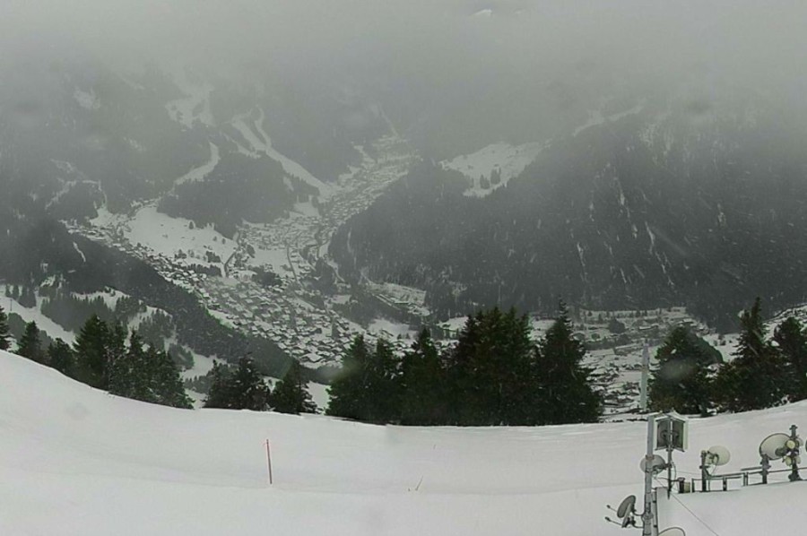 Wet snow turning increasingly to rain across the Châtel area this morning – 7 December 2026 –Photo: chatel.com
Today’s bad weather is concentrated across the western and north-western Alps this morning (e.g. Tignes, Avoriaz, Verbier, Wengen, Zermatt) with a rain/snow limit starting at around 1500m early on but rising to between 2000m and 2400m later.
There are also some showers across the northern Austrian Alps (snow 1400m), otherwise much of the eastern Alps is dry with variable cloud.
The main area of bad weather will reach the western Austrian Alps later today, then other parts of Austria (mostly north of the main Alpine Ridge), with the rain/snow limit rising towards or above 2000m.
Throughout this period the southern Alps will be drier with variable cloud and some sunny spells at times, especially in the far south-west and far south-east.
Next week, the weather in the Alps will be mostly fine and exceptionally mild, with freezing levels generally above 3000m.
This warmer weather means that snow conditions will take a hit over the coming days, especially in the areas that see rain today. On the positive side, the lower ski resorts of the north-western Alps (e.g. Portes du Soleil) have a lot of early snow meaning that, while conditions will deteriorate, it won’t all suddenly disappear, like it has done very early in the season in previous years.
For more details, see our latest Weather & Snow Forecast for the Alps.
For a country by country round-up of snow conditions in the Alps and beyond, see our latest Snow Report. And, for more on how the 2025-26 ski season is stacking up so far in the Alps, check out our latest Season Progress Report!
Updated: 10.20am Saturday 6 December 2025 – The weather is turning much milder in the Alps...
The weather in the Alps remains unsettled but is set to turn much milder with some rain in places on Sunday.
 Good skiing conditions today in Obertauern in the central-eastern Austrian Alps – 6 December 2025 – Photo: foto-webcam.eu
will see a few showers or flurries across the north-western Alps (e.g. Portes du Soleil), especially later in the day, with the rain/snow limit rising to between 1200m and 1700m. This generally won’t amount to much in the way of snow accumulations, although there may be 5–15cm above 2000m in places . Most of the Alps will stay dry, however, with variable cloud.
will see a more active warm front reach the north-western Alps during the day, spreading further east across the northern Alps later. This front will bring some rain to the northern French Alps, much of the Swiss Alps, and later some northern and western parts of the Austrian Alps. The upper limit of this rain could reach 2400–2600m for a time , but more likely 1800–2200m in Austria, before it dies away.
Early next week the weather in the Alps will become drier and brighter, but it will remain very mild with freezing levels as high as 3600m in the west.
Over 250 ski areas in the Alps are now open, with a dozen or so offering more than 100km of slopes, including Ischgl, Zermatt–Cervinia, Val d’Isère–Tignes, Lech–St Anton and the Sella Ronda region, to name just a few.
Snow conditions are going to take a bit of a hit , especially in the lower resorts of the north-western Alps, but at least these areas already have plenty of snow.
Updated: 9am Friday 5 December 2025 – Still changeable weather in the Alps, and turning milder this weekend...
The weather in the Alps remains unsettled with a weak front moving slowly east this morning. Many regions will stay dry but there will be quite a lot of cloud around with a few light flurries here and there, mostly across the eastern Alps where the rain/snow limit will be at or around 700-1000m. The best of any sunshine will in the south-west.
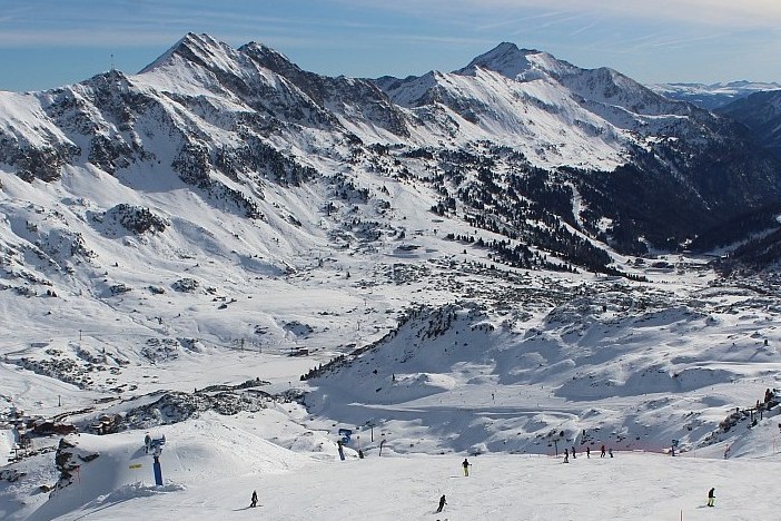
 Cloud breaking over Limone Piemonte in the far south-western Alps, where snow cover is impressive for the time of year – Photo: bergfex.com, 5 December 2025
Over the weekend, further weather fronts will move in from the Atlantic, mostly affecting the northern Alps. These will drag in much milder air, bringing some rain to above 2000m for a time in places, especially in the north-western Alps, before the weather settles down again and stays mild next week.
134 ski areas in the Alps are reportedly open today, with this number set to increase considerably over the weekend.
Ischgl is still offering the greatest extent of open terrain, with 179km of pistes, but there are several other resorts offering more than 100km including Sölden and Zermatt-Cervinia.
The best snow conditions right now are perhaps in the far south-west, which has had the heaviest of the very recent snow (e.g. Isola 2000).
Updated: 10:45am Thursday 4 December 2025 – Fresh snow for some of the Alps, mostly in the south-west...
As expected, there was fresh snow for some parts of the Alps late yesterday and overnight, mostly in the south-west, with resorts like Isola 2000, Auron and Prato Nevoso picking up 15-25cm or so. Some other parts of the Alps picked up a few centimetres, mostly in the west.
 Fresh snow overnight in Auron in the southern French Alps – 4 December 2025 – Photo: auron.com
Today, the weather in the Alps is complicated. Early snow flurries in the southern French and western Italian Alps will tend to die away, leaving most of the Alps dry for a while, but with highly variable cloud cover.
Later today a very weak front will reach the western Alps, bringing a few light snow flurries here and there. A slightly stronger front will also move northwards into the southern Alps and will likely deliver a few centimetres of snow across the Dolomites and the southern Austrian Alps, particularly overnight.
Nearly 100 ski areas in the Alps are open today, mostly still on a very limited basis but with over 100km on offer in a handful of resorts including Ischgl (176km), Val d’Isère-Tignes (110km) and Sölden (115km).
Updated: 9am Wednesday 3 December 2025 – Fresh snow for a lucky few today, mostly in the far south-west of the Alps...
The weather in the Alps is mixed today, with plenty of sunshine in the east (at altitude at least) but more in the way of cloud in the western Alps where some rain or snow is likely at times, especially in the south-west.
 Cloud thickening in Isola 2000 ahead of forecast snowfall later today and overnight – Photo: isola2000.com, 3 December 2025
The area that will see the most snow in the next 24-hours is the far south-western Alps, where 15-30cm is likely (much of it this evening) in the likes of Auron, Isola 2000, Prato Nevoso and Limone Piemonte, with a rain/snow limit between 1000 and 1300m.
Another area that will catch some significant snow is the western foothills of the Alps (e.g. the Vercors and Oisans regions) where 15cm is possible. More generally, though, we will see 5-10cm across the southern French Alps (e.g. Risoul) and south-western Italian Alps (e.g. Sestriere).
Elsewhere in the western Alps, we could see a couple of centimetres here and there (e.g. Val d’Isère, Cervinia) later today/tonight, but most of the Alps will stay dry with the best of any sunshine the further north and east you are.
Tomorrow, another weather front will approach the western Alps with some light flurries likely later in the day. These will push into the same eastern parts of the Alps overnight but will not amount to a great deal.
Updated: 9am Tuesday 2 December 2025 – Mostly dry with variable cloud today in the Alps...
Another mostly dry day is expected in the Alps today, with lots of sunshine in the central and northern Alps, at altitude at least. Further south, it is cloudier with the odd very light shower or flurry in places, especially in the south-east.
 Sunny skies today in St Anton, which opens for the season tomorrow – Photo: foto-webcam.eu, 2 December 2025
, there will be some snow in the far south-western Alps (e.g. Sestriere, Isola 2000) otherwise most places will again be dry with the best of any sunshine the further north and east you are. and will continue to see rather mixed weather conditions across the Alps, with further weak fronts producing a few light showers or flurries here and there but no widespread significant snow.
Nearly 100 ski areas are open across the Alps , 50 less than at the weekend. Most are still only offering very limited skiing, but notable exceptions include Ischgl (159km) and Val d’Isère–Tignes (110km). , we see a major opening in Austria: St Anton–Lech–Zürs in the Arlberg region.
Updated: 10am Monday 1 December 2025 – Mostly fine after overnight top up in north-western Alps...
A mostly dry day is expected across the Alps today, with variable cloud cover but plenty of sunshine at altitude.
 Sprinkling of overnight snow in Saas-Fee – 1 December 2025 – Photo: saas-fee.ch
This follows another top of snow for some last night, mostly in the north-western Alps which saw around 5-10cm of fresh snow, with a bit more in places (e.g. Avoriaz).
This week the weather in the Alps will remain a little mixed. There will be lots of dry weather, but relatively weak fronts will try and move in at times, mostly affecting the south-western Alps mid-week (e.g. Isola 2000) and the south-eastern Alps later in the week (e.g. Dolomites).
Around 100 ski areas are open across the Alps today, down by around 50 from the weekend. Most are still only offering very limited skiing, but there are several notable exceptions including Ischgl (156km) and Val d’Isère-Tignes (150km).
Updated: 11.30am Sunday 30 November 2025 – A small top-up of snow for the north-western Alps later today...
After a largely sunny day in the western Alps yesterday, it is cloudier today ahead of a weak weather front that will bring a little snow to the north-western Alps later today and overnight. The eastern Alps will be dry today, though high cloud will make skies hazy or even mask the sun at times.
 Plenty of early snow in Obertauern in the central-eastern Austrian Alps – 30 November 2025 –Photo: foto-webcam.eu
This latest front will bring only modest amounts of snow – typically 2-10cm in the northern French Alps (e.g. Avoriaz, Flaine, 3 Valleys), the northern and western Swiss Alps (e.g. Verbier, Wengen, Engelberg) and the far west of Austria (e.g. Lech).
Further to the south and east there will be little (if any) snow. The rain/snow limit will typically start at around 1500–1700m before dropping to around 1000m .
Over the next few days, the weather in the Alps will be mostly dry, however, there remains some uncertainty about the forecast for later in the week, when a few showers or flurries are possible in places.
This weekend, nearly 150 ski areas are open in the Alps, many being unscheduled openings thanks to recent snowfalls, including Avoriaz, Megève and La Clusaz. Despite modest snow depths, Ischgl is currently offering the greatest extent of terrain (152km) – as it usually does at this time of year.
Minor resorts in mountain ranges outside the Alps, including the Jura and the Vosges, have also opened terrain – great news for these lower, often forgotten, regions which have had a tough time in recent years.
Read more in our latest country by country weather & snow forecast for the Alps, and find out more about snow conditions in the Alps and beyond in our latest snow report.
Updated: 12pm Saturday 29 November 2025 – Lots more ski resorts opening in the Alps, including some big names…
Two more big name ski resorts, Val d’Isère and Les 2 Alpes, open today with perfect weather and snow conditions as good as you could wish for in November!
 Fabulous weather and snow conditions on opening day in Val d’Isère today. This is the Solaise sector – 29 November 2025 – Photo: valdisere.com
Nearly 150 ski areas in the Alps are open this weekend, many of them unscheduled openings thanks to the recent snowfalls, including Avoriaz, Megève and La Clusaz, to name just a few.
Despite modest snow depths, though, Ischgl continues to offer the greatest extent of terrain (152km) – as it usually does at this time of year.
Notably, some minor resorts in mountain ranges outside the Alps, like the Jura and the Vosges, have also managed to open up some terrain – great news for these lower, often forgotten, regions which have had a tough time in recent years!
Most parts of the Alps are sunny , with some exceptions, especially Austria which has plenty of cloud cover and even a few light flurries in the west. The northern and eastern Swiss Alps also have some cloud , though this should break up later.
A weak weather front will deliver a dusting of snow here and there across some western parts of the Alps , with further weak fronts affecting the Alps at times, though these will not produce much in the way of snow.
Updated: 10am Thursday 27 November 2025 – Winter wonderland in the Alps!
The big storm in the Alps is now over and, at altitude at least, the sun is back! It will remain mostly dry for a couple of days now, but will turn more unsettled again over the weekend, with further snow in some western parts of the Alps, especially on Sunday.
 Sun and snow in Warth-Schröcken today, which is scheduled to open on 5 December 2025 – Photo: warth-schroecken.at, 27 November 2025
’s big opening is Austria’s Ischgl, which immediately claims top spot for the number of km of runs open in the Alps (and in the world) with 143km!
Ischgl joins at least 30 ski resorts open in the Alps – in any of which you can expect blue skies and silky-smooth pistes! Two other good options right now in terms of extent of terrain are Sölden (with 98km) and Zermatt (with 86km). But, as good as conditions may be in these resorts , they are not actually the areas with exceptional snow.
The really big snow snowfalls have been in the north-western Alps, more specifically the northern French and western Swiss Alps. These regions have seen 1m of snow at altitude since , including in ski areas and resorts such as L’Espace Killy, 3 Valleys, Paradiski, La Rosière, La Clusaz, Portes du Soleil, Chamonix valley, Gstaad-Glacier 3000 area, parts of the Bernese Oberland and as far east as Engelberg.
Indeed 1.5m+ was recorded in a few spots, with 174cm between and in L’Ecreleuse (at 2252m), an official Swiss measuring station near the Dents du Midi just to the south of the Portes du Soleil.
In light of these very significant snowfalls, a number of unscheduled openings are also now planned for this weekend, including Avoriaz, Champéry-Les Crosets and La Clusaz, to name just a few.
More on this in our detailed snow report …
Updated: 9.45am Wednesday 26 November 2025 – Final flurries of this epic November storm!
It’s still snowing across some northern parts of the Alps this morning, especially close to the northern foothills. These flurries will continue to low levels on and off for much of the day before finally dying away later, but not before we see several more centimetres of snow.
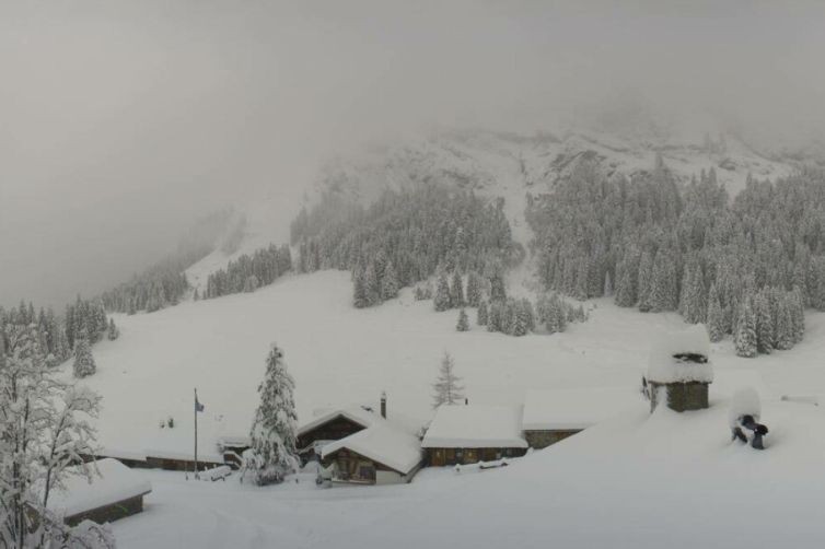 Masses of snow in Villars which, along with many other alpine ski resorts, will open some previously unscheduled skiing this weekend – Photo: villars.ch, 26 November 2025
The weather in the Alpine interior is drier, however, and it is mostly sunny on the southern side of the Alps.
The weather in the Alps will settle down on and before a new storm arrives over the weekend. However, this storm will be a weak affair with just a few centimetres of snow here and there across some western areas.
 Sunnier today on the southern side of the Alps. This is Seiser Alm/Alpe di Siusi in the Dolomites – 26 November 2025 – Photo: foto-webcam.eu
Snow conditions in the Alps are generally excellent for late November, and exceptional even in some north-western parts of the Alps.
Indeed, it is difficult to remember there having been more snow at this time of year in the lower resorts in this region, including the likes of Morzine, Les Gets, Chatel, Megève, La Clusaz, Villars and Gstaad, to name just a few.
We will look more closely at just how ‘historic’ this November snow is in these regions later in the week.
Elsewhere in the Alps, early season snow conditions are also generally good although not everywhere has masses of snow. This includes some very high inner Alpine resorts, like Zermatt and Saas-Fee, which missed out on the heaviest snow and have more “normal” snow conditions for the time of year.
26 ski areas in the Alps are reported to be open today with LOTS more opening later this week or this weekend. This includes several scheduled big-name openings, such as Ischgl and Val d’Isère, but also numerous unscheduled openings thanks to all the fresh snow, including Villars and Avoriaz. More on this in our detailed snow report tomorrow!